March 22 2010 Perth hailstorm
On March 22 2010, severe thunderstorms with hail up to 6 cm in diameter affected Perth.
The severe thunderstorms formed to the north in an unstable atmosphere ahead of an upper/middle level trough/disturbance with steep vertical lapse rate and also significant vertical wind shear.
The severe thunderstorms formed to the north in an unstable atmosphere ahead of an upper/middle level trough/disturbance with steep vertical lapse rate and also significant vertical wind shear.
3D radar image of March 22 2010 while it was above UWA with the left panel showing a cross section along the dotted line:

Image courtesy of WeatherWatch.
Radar loop:

Image courtesy of the Australian Bureau of Meteorology (BOM).
Satellite image:

Image courtesy of the Australian Bureau of Meteorology (BOM) and Japanese Meteorological Agency (JMA).
Mean Sea Level Pressure Chart (MSLP) 00Z March 22 2010:

Image courtesy of the Australian Bureau of Meteorology (BOM).
500 hPa chart 00Z March 22 2010:
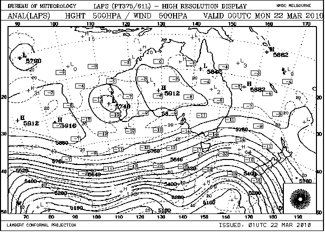
Image courtesy of the Australian Bureau of Meteorology (BOM).
Convective Available Potential Energy(CAPE) map 2 PM March 22 2010:

Image courtesy of Meteologix.
2 PM March 22 2010 vertical wind shear map:

Image courtesy of Meteologix.
2 PM March 22 2010 500 hPa wind map:

Image courtesy of Meteologix.
2 PM March 22 2010 500 hPa temperature map:

Image courtesy of Meteologix.
2 PM March 22 2010 850 hPa wind map:

Image courtesy of Meteologix.
2 PM March 22 2010 850 hPa temperature map:

Image courtesy of Meteologix.